
December 2017 Issue
Researcher Video Profiles
Hideyuki Fujita, Assistant Professor, Graduate School Informatics and Computer Engineering.
Development of interactive software using geospatial information
Hideyuki Fujita, Assistant Professor, Graduate School Informatics and Computer Engineering.
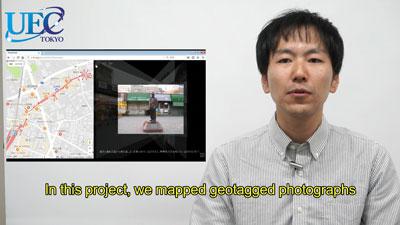
Hideyuki Fujita is an expert on the development of interactive software using geospatial information. His motivation is to analyze data from consumer generated media to understand locations and human behavior. In a recent project, he has mapped geotagged photographs to arrows indicating from where to where each photo was taken. In this framework, he has proposed new methods for creating street view animation, spatial search based on spatial relationships, and geospatial storytelling environment. "We will put more focus on the spatial and semantic structures of geospatial information," says Fujita.
Further information
Hideyuki Fujita
Assistant Professor, Graduate School Informatics and Computer Engineering.
The University of Electro-Communications, Tokyo.
Website:http://www.is.uec.ac.jp/staff/list/fs/fujita-hideyuki.html
Research Highlight:Geospatial information extraction from SNS: Who said what from where!